More pages in this section
Page last updated on 07-08-2026.
Dredge Management
Long-Term Maintenance Dredging Management Plan (LTMDMP)
The LTMDMP is the Port of Townsville's long-term environmental management framework for maintenance dredging, ensuring that essential shipping access can continue while environmental values, including those of the Great Barrier Reef and Cleveland Bay, are protected and monitored.
A Long-Term Maintenance Dredging Management Plan (LTMDMP 2019-2029) has been approved by Federal and State regulators in accordance with both the Federal and Queensland State guidelines.
The Port has updated this LTMDMP to align with the permit duration and this draft LTMDMP (2027-2037) document is provided below as part of the consultation process. Following feedback from the consultation process, the LTMDMP will be finalised and supplied as part of the supporting information to the 10-year sea dumping permit application.
LTMDMP 2019-2029 Draft LTMDMP 2027-2037
The Queensland Maintenance Dredging Strategy (MDS) provides a framework for sustainable, leading practice management of maintenance dredging at ports in the Great Barrier Reef World Heritage Area, which includes the Port of Townsville.
With 17 key guiding principles and 5 targeted actions, the strategy ensures maintenance dredging continues in an environmentally sustainable manner and provides safe and efficient navigation within Great Barrier Reef World Heritage Area ports.
The MDS and associated technical information has informed the Port of Townsville's LTMDMPs.
Sediment Monitoring and Management
Only material assessed as suitable for unconfined sea placement under the National Assessment Guidelines for Dredging (NAGD) 2009 and subsequent Commonwealth guidance can be placed at the Dredge Material Placement Area (DMPA). This ensures that only clean, environmentally acceptable material—verified through sediment chemistry testing, elutriate analysis, and risk assessment—is approved for sea placement.
Every five years, the Port undertakes a comprehensive Sediment Sampling and Analysis Plan (SAP) to characterise sediments within maintenance dredging areas. This assessment is carried out in accordance with the NAGD to determine which areas contain material suitable for unconfined sea placement at the Port’s approved DMPA.
Sediment Analysis Plan - Fact Sheet NAGD Guideline
The LTMDMP has also taken into consideration a range of research and monitoring undertaken by the Port and the Queensland Ports Association (QPA). This includes the Reef 2050 Long Term Sustainability Plan Water Quality Action 17 (WQA17) which had the objective to understand how port sediment characteristics and risks interact with broader catchment sediment contributions within the GBR.
Studies were led by the QPA and major assessments undertaken at the Port of Gladstone, Hay Point, Mackay, Abbot Point, Townsville and Cairns. The assessments were aggregated into an overall inner-shelf sediment budget for the Great Barrier Reef, supported by a quantitative technical report compiled by independent technical consulting firm BMT WBM Pty Ltd which details a quantitative sediment budget of the entire Great Barrier Reef and regions surrounding the Great Barrier Reef ports. For Townsville, comparing the relative mass of sediment resuspended naturally to that from maintenance dredging at a port scale shows that maintenance dredging contributes the equivalent of 2.9% of the annual natural resuspension as depicted below (BMT WBM 2018).
The report has also been independently peer reviewed by Dr Andy Symonds from Port and Coastal Solutions Pty Ltd. A copy of this report and the peer review can be found below.
Water Quality Action 17 Peer Review
Hydrodynamic modelling was used to predict how maintenance dredging may affect:
- Water quality;
- Turbidity (water clarity);
- Sediment deposition; and
- Sensitive marine habitats such as seagrass and coral reefs.
The modelling uses specialised computer software to simulate tides, currents, waves, water movement, sediment transport and dredge plume behaviour, allowing predictions of how sediment released during maintenance dredging may move through Cleveland Bay and the surrounding marine environment.
The model helps predict how sediment released during maintenance dredging moves through Cleveland Bay and the surrounding marine environment.
Across all dredging volumes and climate conditions assessed, maintenance dredging impacts are predicted to remain localised and temporary. No adverse impacts are predicted for mapped coral habitats, and only a small area of mapped seagrass is predicted to experience minor, temporary and recoverable effects. Overall, the assessment concluded that maintenance dredging and placement is unlikely to result in measurable long-term impacts to sensitive marine habitats in Cleveland Bay.
Further information on the turbidity modelling can be found below and in the draft LTMDMP 2027-2037.
Hydrodynamics - Technical Summary Hydrodynamics Modelling - Fact Sheet
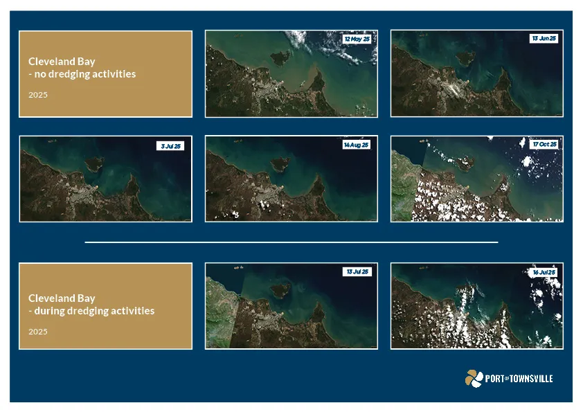
The Port of Townsville has invested in new scientific tools to improve the way water quality is monitored in Cleveland Bay. A satellite-based monitoring method was developed using imagery from Earth-observing satellites to accurately estimate levels of sediment in the water.
Satellite monitoring allows scientists, regulators and the port to observe water quality conditions across the whole of Cleveland Bay and surrounding coastal waters at a scale that cannot be achieved through boat-based monitoring alone.
Animated imagery of two different visualisations showing monthly total suspended solids (TSS) from the satellite monitoring.
An anomaly map compares current sediment conditions with what would normally be expected for that location and time of year. This helps identify whether sediment levels are unusually high, unusually low or within the normal range of natural variation.
The algorithm allows TSS across the bay and the region to be estimated. This created a consistent long-term dataset extending from approximately 2009 onwards, allowing assessment of historical trends and environmental baselines.
This approach is used in conjunction with satellite imagery and informs the Port's adaptive management.
Environmental Monitoring and Management
As part of the LTMDMP the Port has undertaken a risk assessment of maintenance dredging and placement activities. The detailed risk assessment can be found in the draft LTMDMP 2027-2037.
A summary of the key environmental risks and management actions are outlined below.
Managing Environmental Risks - Technical Summary
Townsville Dredging EMP - 2025
The Port has undertaken a comprehensive range of environmental monitoring programs for more than 20 years and has embedded ongoing monitoring into the draft LTMDMP for the permit period 2027-2037.
These programs collect data to support the ongoing protection of the environmental values of Cleveland Bay and surrounding areas, as well as to inform the Port’s broader environmental understanding of the local environment and inform adaptive management of maintenance dredging and placement.
Environmental conditions in Cleveland Bay are influenced by many interacting natural factors, including weather, river flows, cyclones and marine heatwaves. The monitoring programs are designed to help understand these broader patterns over time.
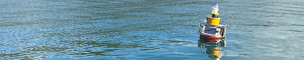
Water quality in Cleveland Bay, especially turbidity and light levels, is highly influenced by a range of factors. This is monitored by the Port to inform adaptive management.
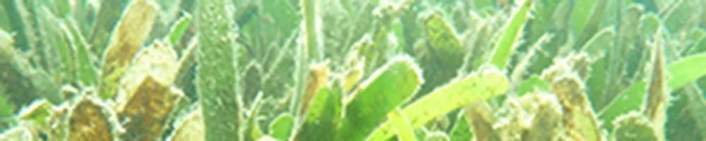
Seagrass meadows are an important habitat in Cleveland Bay supporting dugongs and turtles and also helps to stabilise sediments. The Port continues to monitor seagrass meadows to understand the changes in habitat from year to year and to inform adaptive management.
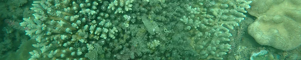
Coral reefs are an important habitat in Cleveland Bay. The Port continues to monitor corals to understand the changes in habitat from year to year and to inform adaptive management.

Benthic fauna play an important role in the Cleveland Bay dredge material placement area (DMPA). The Port has monitored benthic fauna to inform adaptive management.
Alternatives
As outlined in the Port’s Long Term Maintenance Dredging Management Plan, a range of alternatives have been considered and assessed by the Port including alternative dredge material placement areas. Options were evaluated against environmental, technical, operational and economic criteria.